MapInfo Professional®
MapInfo Professional helps business analysts, planners, GIS professionals - even non-GIS users - gain new insights into their markets, share information-rich maps and graphs and improve strategic decision-making.

| Overview | Key Features | Specifications | Resources |
See your business data in a bold new way with MapInfo Professional, a powerful mapping and geographic analysis application providing geospatial data solutions. MapInfo Professional helps you present your business findings in a new, more visual way. It clearly demonstrates the relationship between geography and data, thanks to its detailed maps and graphics.
The sophisticated functions provided by MapInfo Professional allow clients, colleagues and business partners to:
- Better absorb information
- Gain new insights into hidden trends
- Have a better basis for strategic decision-making.
Download your free 30-day trial of MapInfo Professional.
Integrate geospatial data solutions into business processes
MapInfo Professional provides a new perspective on your business. With this powerful mapping app, you can:
- Manage location based assets, such as human resources and property
- View and optimise territories to boost efficiency
- See where infrastructure and utilities are needed
- Plan ahead for emergencies
- Map resources and plan logistical support
MapInfo Professional Key Features
Upgrade your business to MapInfo Professional today
Simple IT integration
- MapInfo Professional is an innovative way to look at and manage your business and is compatible with many existing operating systems, databases and office applications.
- Import your existing data from spreadsheets and databases, and publish content to high-quality maps.
- MapInfo Professional is also easily customized, giving you the business information you need most.
Get your free trial of MapInfo Professional now.
MapInfo Professional is a powerful mapping tool, and is packed with features to help you to see trends and patterns, so you can make informed decisions and develop your business.
Easy to use and integrate
MapInfo Professional is an extremely flexible mapping tool, and you can integrate it directly with your current IT systems. It's also extremely user-friendly, so you don't need to be an IT expert to be able to use it.
Data is easily accessible
MapInfo Professional supports a range of data formats, so you can see data from Microsoft Excel, Microsoft Access, Oracle, Microsoft SQL Server and more directly. You can also view images of virtually any format.
Superb data creation and editing functions
Choose MapInfo Professional and you'll be able to access a great selection of CAD data creation and editing tools, and edit tabular data, like values and names.
MapInfo Professional allows you to make changes to all your maps and data in a single application, so you don't have to keep switching - saving you time and effort.
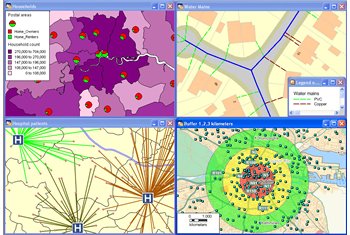
Flexible map display options
MapInfo Professional provides you with an outstanding range of map display options:
Using the software's simple to use map display wizard, you can shade/change style or mark:
- territories (using any symbol, graduated symbols, charts or graphs)
- boundaries
- highways
- fiber lines
- points.
You can also aggregate values using statistical or any math functions to associate a symbol or color to a point or a region based on a calculated value. For example, you can use MapInfo Professional to shade your sales territories according to the number of customers you have there.
Effective data sharing capabilities
MapInfo Professional makes data sharing easy, thanks to its wide range of data publishing options.
Everything from exporting your data to any format, to publishing large maps with legends and charts is possible with MapInfo Professional, and it's also web-enabled. Simple-to-use wizards enable you to publish static and interactive maps without any hassle, so you can share your results with everyone you need to.
Try MapInfo Professional for free for 30 days.
Operating Systems
Desktop
- Windows XP Professional 32-bit
- Service Pack 3 (SP3)
- Windows 7 Ultimate 32-bit SP1
- Windows 7 Ultimate 64-bit SP1 with 32-bit compatibility mode
- Windows 8 32-bit
- Windows 8 64-bit
Server
- Windows 2008 Server R2 64-bit SP1 with XenApp 6.0
- Windows 2008 Server R2 64-bit SP1
- Windows 2012 Server 64-bit
Database Servers
Spatial
- Microsoft SQL Server 2008 (also called SQL Server Spatial)
- Microsoft SQL Server 2012 (also called SQL Server Spatial)
- Oracle Spatial 11Gr2, 10Gr2
- PostgreSQL 9.0.3 with PostGIS 1.5
- PostgreSQL 9.x with PostGIS 2.0.x
- FDO 3.8
XY
- Microsoft Access 2007, 2010
- Microsoft Office 2013
- Microsoft SQL Server 2005
Database Connectivity
- ODBC Drivers
- Microsoft SQL Server 2008 Native
- Client v10
- Oracle ODBC Driver 11.2
- PostgreSQL ANSI ODBC driver
- 9.01.02
- Oracle OCI Client
- Oracle Instant Client
Support
Data Sheets and Brochures
- MapInfo Professional v12.0 Data Sheet
- MapInfo Professional v12.0 Brochure
- MapInfo Professional v12.0 Version Comparison
- MapInfo Professional Data Directory
- MATS: End-User Data Sheet (Maintenance and Technical Support)
- MI Pro Premium Data Sheet